Malasaña is a district in central Madrid, part of the Universidad ward within the Centro district, sitting north of Gran Vía. The name comes from Manuela Malasaña, a young woman traditionally said to have been killed there during the anti-French uprising of 2 May 1808, an event the area still commemorates in its central square.
Where exactly is Malasaña?
Malasaña is bordered roughly by Gran Vía to the south, Calle de Fuencarral to the east, Calle de San Bernardo to the west, and Glorieta de Bilbao to the north. Administratively, it corresponds to the Universidad neighbourhood, one of the six that make up Madrid’s central Centro district, as defined by the Ayuntamiento de Madrid’s own district map.
It sits within walking distance of Gran Vía, the avenue cut through the old city in the early twentieth century, and is often discussed alongside other historic central quarters such as La Latina and Lavapiés, though each has a distinct street pattern and history.
Where does the name Malasaña come from?
The district takes its name from Manuela Malasaña, a figure associated with the Madrid uprising against Napoleonic troops on 2 May 1808. Municipal historical accounts, including material held by the Museo de Historia de Madrid, record the traditional version of her story: a young seamstress, in her mid-teens, killed by French soldiers that day near the Monteleón artillery barracks.
The most commonly repeated account holds that she was detained for carrying a pair of scissors used in her sewing work, which soldiers treated as a concealed weapon during a period of martial law imposed after the uprising began. Historians note that documentary evidence from the period is thin, and some details of her story — her exact age, occupation and the precise circumstances of her death — vary between sources and cannot be verified with certainty. What is not in dispute is that she became one of a small number of named civilian victims of 2 May 1808 whose memory the city formally attached to this part of the old quarter.
Streets nearby carry the names of other figures from the same episode: Calle de Daoíz and Calle de Velarde, after the two artillery officers who led resistance at the Monteleón barracks and were killed in the fighting. The barracks itself stood on the site of what is now the district’s main square.
What was the area called before it was Malasaña?
Before the name Malasaña became standard, the district and its surrounding streets were generally known as the Maravillas quarter, after a parish dedication in the area (Nuestra Señora de las Maravillas). Older maps and documents referring to this part of Madrid use “Maravillas” rather than “Malasaña”, and some long-standing local institutions still carry that older name. The shift to “Malasaña” as the popular name for the neighbourhood happened gradually, reinforced by the naming of the square at its centre.
What is the Plaza del Dos de Mayo?
The Plaza del Dos de Mayo is the district’s central square, built on the former grounds of the Monteleón artillery barracks, the site of the fiercest fighting during the 1808 uprising. A brick gateway and a monument in the square are the surviving architectural remnants connected to that history, and the square’s name — “Second of May” — commemorates the date directly.
The square functions today as the informal centre of the district: a public open space surrounded by residential buildings, used for daily neighbourhood life rather than as a monument in the manner of, say, Plaza Mayor or Plaza de Cibeles. It is a working square, not a formally curated historical site, though the 1808 connection is marked with commemorative elements maintained by the city.
How did Malasaña become linked to the Movida Madrileña?
Malasaña’s more recent identity comes from the late 1970s and early 1980s, when the district became one of the centres of the Movida Madrileña — the wave of cultural and social activity that followed the end of the Franco dictatorship in 1975 and the loosening of censorship and social restrictions that followed. Cultural histories of the period, including retrospectives produced by Spanish state broadcasters and cultural institutions, place Malasaña alongside a handful of other Madrid districts as a focal point for the music, nightlife and visual art associated with that era.
That period left a lasting association between the district’s name and a particular strand of Madrid’s cultural history, distinct from the earlier, 1808-era origin of the name itself. The two things — the historical figure and the twentieth-century cultural movement — are separate but are often mentioned together in accounts of the neighbourhood, since both are central to how the district is described today.
What does the district look like today?
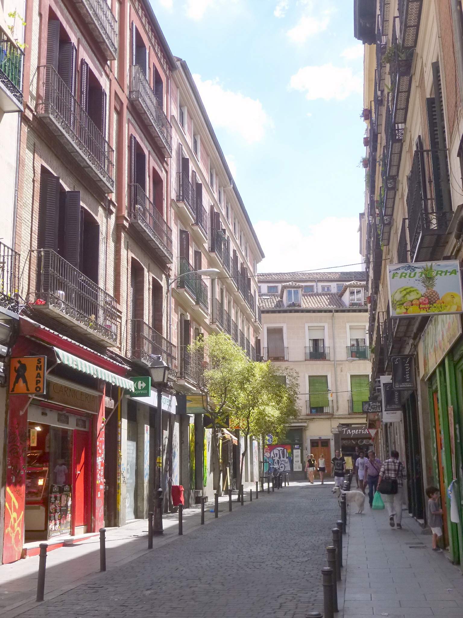
Malasaña’s street plan is largely a legacy of its eighteenth- and nineteenth-century development: narrow streets, low-rise buildings with balconies, and a dense grid rather than the wide boulevards found nearer Plaza de España or along Gran Vía. Much of the building stock dates from the eighteenth and nineteenth centuries, with later infill.
The area functions primarily as a residential and commercial district, with independent shops, a concentration of bars and small venues, and a market building — the Mercado de San Ildefonso — that operates as a covered food hall rather than a traditional produce market. As with other central districts, specific businesses open and close regularly, so this article does not attempt to catalogue them; readers looking for current listings should consult the operators’ own sites or the city’s official tourism portal, esmadrid.com.
How do you get to Malasaña, and how does it fit into central Madrid?
The district is served by several Metro de Madrid stations at its edges, including Tribunal, Bilbao, Noviciado and San Bernardo, all on lines operated by Metro de Madrid, whose own site carries current route maps and fare information. Its central location means it is reached on foot from Gran Vía or Sol in a matter of minutes, and it borders the Chueca and Conde Duque areas, both part of the same broader central swathe of the city.
For a resident, Malasaña functions as a dense, walkable residential district with a high concentration of small independent retail — the kind of area where daily life happens on foot rather than by car, consistent with the pattern of Madrid’s historic centre generally. For a visitor, it reads as one of several distinct central quarters worth distinguishing from each other rather than treating as interchangeable with, for instance, La Latina or Lavapiés, each of which carries its own separate history and character.
Where to check further detail
Readers wanting to verify specifics — ward boundaries, listed monuments, current opening arrangements at the Mercado de San Ildefonso or the Plaza del Dos de Mayo — should consult the Ayuntamiento de Madrid’s own district pages and esmadrid.com, the city’s official tourism site, both of which are updated directly by the relevant public bodies. Wider context on Madrid’s central districts and their landmarks is covered across this site’s Neighbourhoods and Landmarks & Sights sections.
Access Madrid is an independent guide written from published, checkable sources. We have not visited the places described here and we do not publish personal recommendations or invented ‘local favourites’ — where something is singled out as notable, we say who says so. Opening times, fares, closures and prices change at short notice, so treat everything here as a starting point and confirm with the museum, operator or venue directly before building a day around it. We give no advice on visas, insurance, health or safety; use your own government’s official guidance for those.