The Sierra de Guadarrama is the mountain range that closes off the northern edge of the Madrid basin, part of the wider Sistema Central that runs across the middle of the Iberian Peninsula. Its nearest ridges lie roughly 50–60 km from central Madrid, and its closer towns are reachable by suburban train in under two hours, which makes it the region’s most accessible mountain landscape rather than a distant excursion.
What exactly is the Sierra de Guadarrama?
It is a granite mountain range forming part of the Sistema Central, the chain that divides the northern and southern halves of the Iberian plateau. It stretches roughly northeast to southwest along the boundary between the Community of Madrid and the province of Segovia.
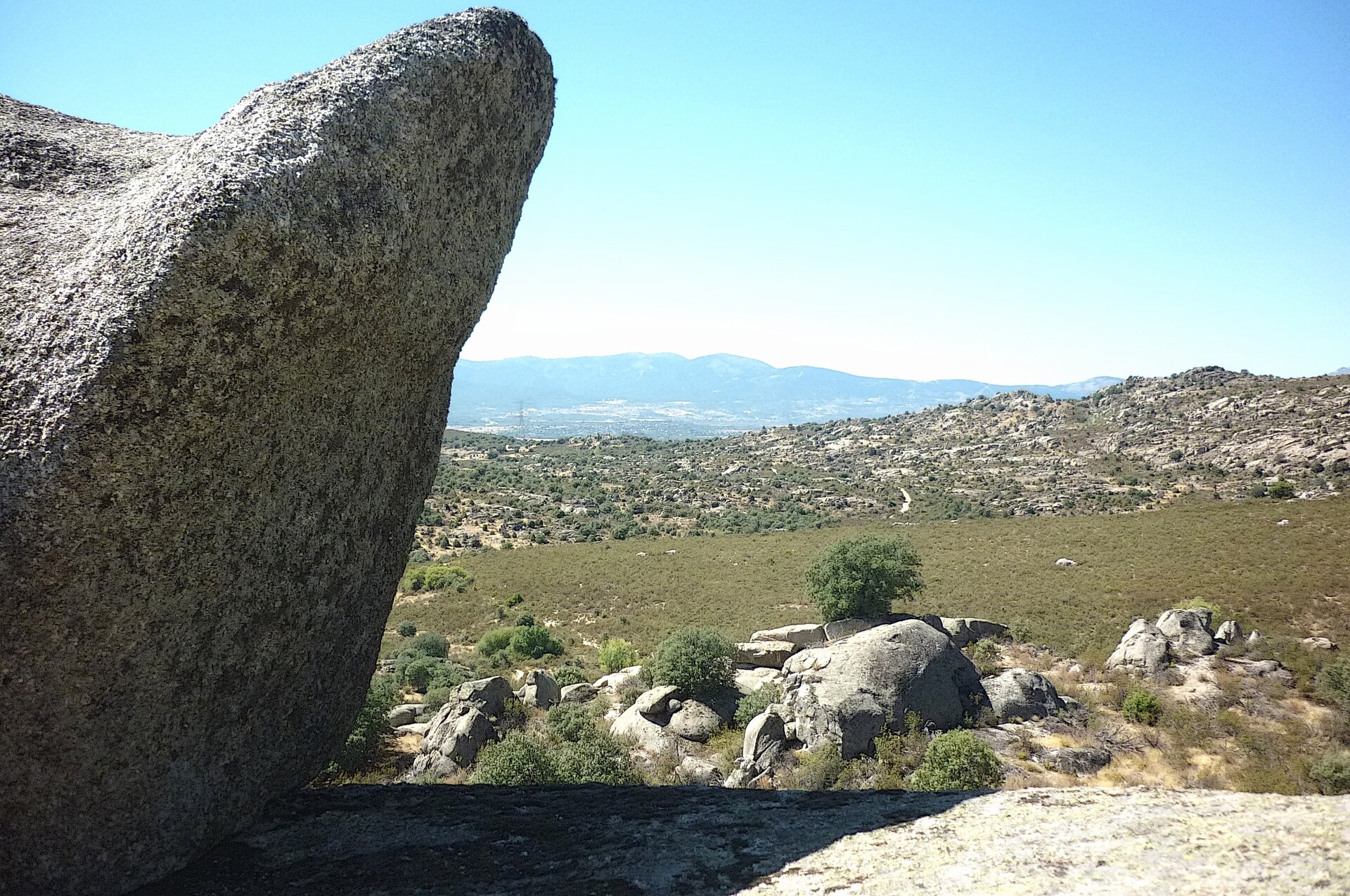
Its high point is Peñalara, at 2,428 metres, and the range is characterised by exposed granite outcrops, pine forest at mid-altitude, and high pasture above the treeline. In 2013 the Spanish government designated a core section as the Parque Nacional de la Sierra de Guadarrama, one of Spain’s national parks — a category reserved for landscapes judged to represent an ecosystem of national significance largely undisturbed by human activity. The park’s own site, run by the Ministerio para la Transición Ecológica, sets out its boundaries and the rules governing access.
How far is it from central Madrid?
The distance from Puerta del Sol to the range’s nearest access points, around Cercedilla or Puerto de Navacerrada, is on the order of 55–65 km by road. That places it within day-trip range for anyone based in the city, without requiring an overnight stay.
This proximity is unusual for a European capital. Few major cities sit this close to terrain above 2,000 metres, and the closeness has shaped how madrileños actually use the mountains — less as a remote wilderness, more as an extension of the city’s own outdoor life, reached in the time it takes to cross town on a bad day.
How do you get there without a car?
The Cercanías suburban rail network, operated by Renfe, runs a line toward the sierra from Madrid’s main stations, terminating at Cercedilla. From there, a separate narrow-gauge branch — often called the Tren de la Sierra — climbs further into the mountains toward Puerto de Los Cotos, passing close to Puerto de Navacerrada.
This combination means the range is reachable entirely by rail from central Madrid, without a transfer to a coach or a hire car. Readers checking the current timetable and fare should confirm details directly through Renfe’s own site, since suburban services are adjusted seasonally. The general logic of the Cercanías system, and how it differs from the metro, is covered separately in the Getting Around archive.

What is actually inside the national park?
The protected area covers high granite peaks, glacial cirques left from the last Ice Age, extensive Scots pine forest, and habitat for species including the Spanish ibex and a number of birds of prey. Peñalara itself sits within the park and is its best-known summit.
The park authority manages visitor centres and marked routes, and access to some zones is restricted or seasonal, particularly around the more fragile high-altitude lagoons. Anyone planning to walk in the park should treat the official park site as the source for current route conditions, closures and any permit requirements, rather than a general guide.
What towns sit at the edge of the range?
A handful of towns anchor the sierra’s foothills and give it its practical shape for anyone travelling from Madrid:
- Cercedilla — the main rail gateway into the high sierra, and the interchange point for the narrow-gauge line further up.
- Manzanares el Real — sits beneath La Pedriza, a distinctive granite massif within the park known for its rock formations and climbing routes.
- Rascafría — in the Lozoya valley, near the Monasterio de Santa María de El Paular, a Carthusian monastery founded in the 14th century.
- San Lorenzo de El Escorial — sits at the range’s southern foot rather than inside it, best known for the royal monastery complex built under Felipe II.
None of these are part of central Madrid’s district system, which is covered separately in the piece on how Madrid’s districts and barrios are organised, but they function as the city’s nearest true countryside.
Why does the sierra matter to how Madrid actually works?
Beyond recreation, the range has two durable, checkable roles in the city’s own infrastructure. Its granite was quarried to build much of historic Madrid, including major public buildings, which is why the city’s older stonework has a consistent grey-white character. Its reservoirs — including Santillana, fed by rivers descending from the sierra — form part of the Canal de Isabel II system that supplies Madrid’s drinking water, a public utility with its own long institutional history.
The range also historically supported a small skiing industry centred on Puerto de Navacerrada, and remains the primary reference point for hiking, climbing and winter sports for people living in the capital, in the way that a resident of a coastal city might treat the nearest beach. That everyday relationship — mountains as a normal weekend option rather than a special occasion — is part of what distinguishes living in Madrid from visiting it, a distinction explored more broadly on the Living in Madrid hub.
Is a visit to the sierra a day trip, or does it need more time?
For most itineraries built around central Madrid, the sierra functions as a single day out rather than a stop requiring accommodation. A train to Cercedilla, a walk in the surrounding forest or a further ride up toward Los Cotos, and a return in the evening is a realistic shape for one day, weather permitting.
Anyone building a longer stay in the capital and wondering where a mountain day fits among museum time and central neighbourhoods can find the general logic of sequencing a Madrid stay in the piece on planning a first visit in a sensible order, and the broader question of what a third or fourth day in the city makes room for is addressed in what a third day in Madrid makes room for.
Because conditions in the high sierra shift sharply with season — snow closing routes in winter, heat making exposed granite unpleasant in August — it is worth cross-referencing how the city itself handles the same extremes, covered in how Madrid handles summer heat and in the seasonal overview at what happens to Madrid in August.
What should a reader confirm before going?
Three things change often enough that this article deliberately does not fix them: the Cercanías and narrow-gauge timetables, which are set by Renfe and adjusted seasonally; access restrictions inside the national park, which the park authority publishes directly; and weather at altitude, which can differ sharply from conditions in the city below on the same day.
None of these are matters this site can responsibly guess at, which is why the operator’s and park authority’s own sites are the right final check, not a general guide written from Madrid at sea level.
For context on how this kind of green, mountainous edge compares to the parks and open spaces inside the city itself, the Parks & Outdoors archive covers Madrid’s own green infrastructure, from the Retiro to the far larger Casa de Campo, in the same evidence-based way applied here to the sierra beyond the city limits.
Related reading
getting around, planning, itineraries, food and green space, museums, landmarks, neighbourhoods and day trips, Is Cuenca a Day Trip From Madrid, or an Overnight?, What Is Chinchón? Madrid’s Plaza Mayor Day Trip
Access Madrid is an independent guide written from published, checkable sources. We have not visited the places described here and we do not publish personal recommendations or invented ‘local favourites’ — where something is singled out as notable, we say who says so. Opening times, fares, closures and prices change at short notice, so treat everything here as a starting point and confirm with the museum, operator or venue directly before building a day around it. We give no advice on visas, insurance, health or safety; use your own government’s official guidance for those.
Featured image: Photo by CARLOS TEIXIDOR CADENAS, source, CC BY 4.0
