Arganzuela is one of Madrid’s 21 administrative districts, sitting immediately south of the historic centre along the Manzanares river. Madrid Río is not a district but a long riverside park, built largely within Arganzuela, that covers a stretch of ring road buried underground between 2005 and 2011. One is an area of the city; the other is what now sits along its edge.
What is Arganzuela, exactly?
Arganzuela is a district of Madrid’s municipal government, one of the administrative units the city is divided into for planning and services. It runs roughly from the southern edge of the historic centre down to the M-30 ring road, bounded on its western side by the Manzanares.
Like all of Madrid’s districts, Arganzuela is subdivided into smaller neighbourhood units, or barrios: Imperial, Acacias, Chopera, Legazpi, Delicias, Palos de la Frontera, and Atocha. Each has its own character, but they share a common thread — this was, for most of the 20th century, a working district of rail yards, slaughterhouses, warehouses and workshops rather than a residential or visitor-facing one.
Where is Arganzuela in relation to the rest of Madrid?
It sits directly south of La Latina and Lavapiés, separated from them by the old city boundary along Calle de Toledo and the Ronda de Toledo. The Puerta de Toledo gate marks something close to that boundary today, standing at the point where the old city gave way to what were once outlying industrial grounds.
To the west, Arganzuela meets the Manzanares river itself, and beyond it the Casa de Campo. To the south lie Atocha station’s rail approaches and the Delicias area, home to the former Estación de Delicias building, now a railway museum. The district is well served by Madrid’s transport network, with several Metro lines and Cercanías (commuter rail) stops crossing it, including interchange stations near Atocha and Legazpi.
Why was Arganzuela industrial rather than residential?
Arganzuela developed through the 19th and 20th centuries as Madrid’s utilitarian back area — the part of the city where things arrived, were processed, or were slaughtered, rather than where people came to look at anything. Its position next to the river and the railway lines running south out of Atocha made it a logical site for exactly that kind of infrastructure.
The clearest surviving trace of this is Matadero Madrid, the city’s former municipal slaughterhouse and livestock market, built in the early 20th century in a Neomudéjar brick style. It operated as an abattoir until the 1990s and was later converted into a public cultural centre, run by the city council, hosting exhibitions, performance and design programming. The building itself — its scale, its brick pavilions, its long covered halls — is a document of what this stretch of the district was built to do before any of it was parkland.
What is Madrid Río?
Madrid Río is a linear park running along both banks of the Manzanares, largely through Arganzuela and neighbouring districts, built on top of a section of the M-30 ring road that was rerouted underground. The project was carried out by Madrid City Council and completed in 2011, replacing what had been an elevated and surface motorway corridor along the riverbank.
Before the project, the M-30 ran at grade or on viaducts directly alongside the river through this stretch, cutting the city off from its own waterfront both physically and audibly. Burying that traffic in tunnels freed the surface for parkland, cycling and pedestrian routes, and new public space — reported by the city council as one of the largest urban infrastructure projects undertaken in Madrid in decades.
How was the M-30 buried, and why does that matter for the park?
The M-30 is Madrid’s inner ring road, a motorway that circles the historic centre and carries a large share of the city’s through traffic. Along the section fronting Arganzuela and the river, the road was rerouted into tunnels running beneath the new park, rather than removed altogether — the traffic still exists, it simply runs underground.
This distinction matters for understanding what Madrid Río is: it is not reclaimed derelict land, but a park built directly over active road infrastructure. The tunnels underneath continue to carry a significant volume of the city’s ring-road traffic, according to the city council’s own account of the project, while the surface above is given over entirely to pedestrians, cyclists and green space.
What is actually inside Madrid Río?
The park is less a single space than a corridor of connected pieces running for several kilometres along both banks of the Manzanares. Its components, as documented by the city council and by architectural coverage of the project, include:
- Continuous pedestrian and cycling paths along both riverbanks, linking district to district in a way the old motorway corridor did not allow.
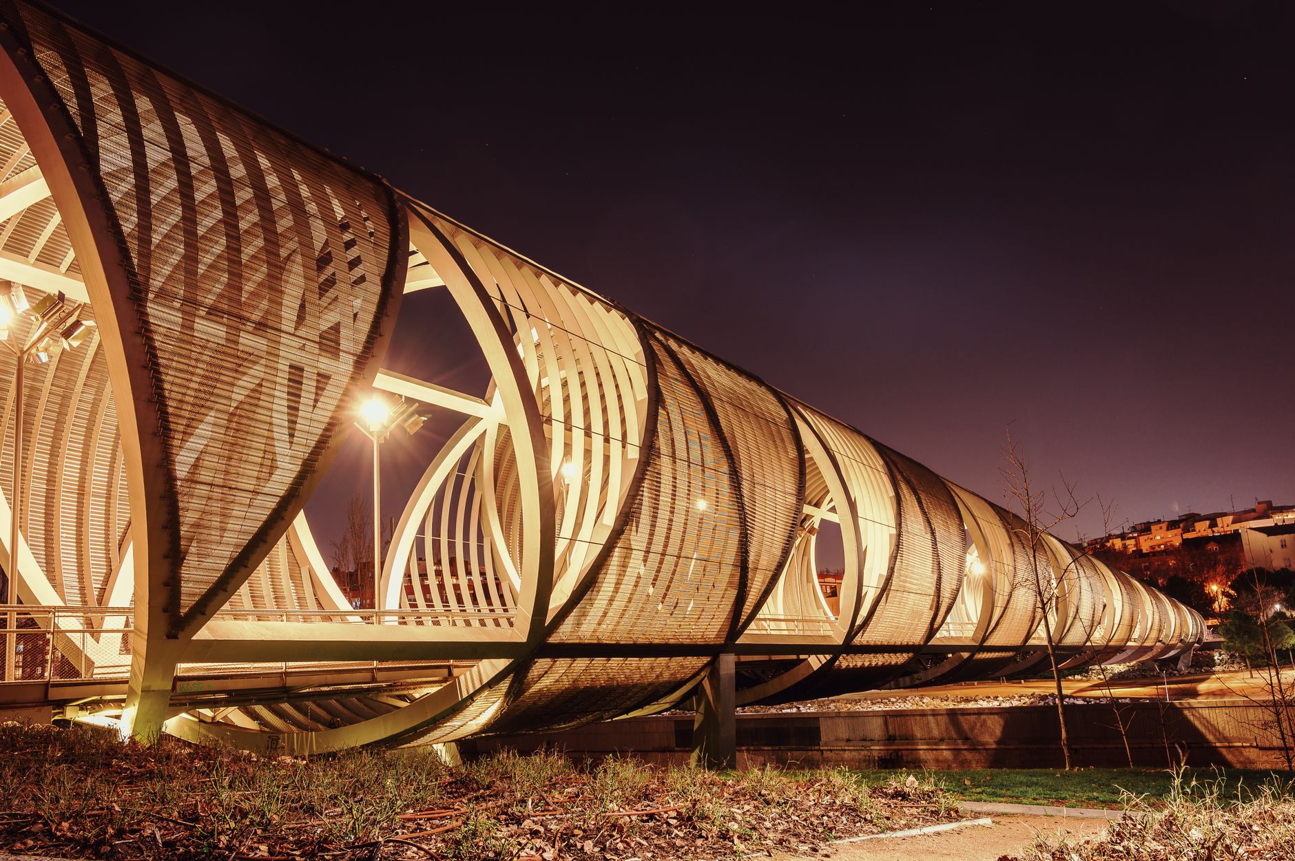
- A series of new and remodelled bridges, including the historic Puente de Toledo and Puente del Rey, both restored as part of the works, alongside newer footbridges built specifically for the park.
- Public fountains and shallow water features, informally known locally as the “Playa de Madrid Río”, used seasonally by families in warm weather rather than for swimming in any formal sense.
- The Matadero Madrid cultural complex, sitting within the park’s southern stretch and connected to it directly.
- Areas of planting and tree cover intended, per the council’s project documentation, to soften what had previously been a heavily paved and traffic-dominated riverbank.
The park connects at its western end to the much larger Casa de Campo, Madrid’s largest public park, giving the combined green corridor a footprint that runs well beyond Arganzuela’s own boundaries.
Is Madrid Río built for residents or for visitors?
Its primary function, based on how the city council describes and funds it, is as public infrastructure for residents — cycling and running routes, family space, and a green corridor connecting districts that were previously separated by a motorway. It was not built or marketed as a tourist attraction in the way a landmark or museum is, and it carries no admission charge or opening hours in the way a monument does.
That said, it is genuinely used by visitors too, particularly those staying near the historic centre who walk or cycle south past the Puerta de Toledo and along the river. Its interest for a visitor is less any single feature than the fact that it makes visible how a modern European capital dealt with a mid-century motorway running through its centre — by putting it underground rather than removing it.
How does Arganzuela fit alongside Madrid’s more central districts?
Arganzuela does not carry the same weight in guidebooks as the districts immediately to its north, and it has no equivalent to the layered history covered in explainers on Madrid de los Austrias or the literary associations of the Barrio de las Letras. Its interest is different in kind: it is a working-class, industrial district whose defining transformation happened recently and is still visible, rather than one shaped by centuries of court and church history.
For a resident, that makes Arganzuela a practical district as much as a scenic one — Metro and Cercanías connections, a large park usable year-round, and a converted industrial complex that now runs a genuine public cultural programme. For a visitor, it is worth understanding as the place where the Puerta de Toledo gate stops marking the edge of old Madrid and the river corridor begins.
Where can you check current details for Madrid Río and Matadero Madrid?
Programming at Matadero Madrid, and any specific events or closures affecting Madrid Río, change over time and are best confirmed directly with the operators. Madrid City Council publishes information on the Madrid Río project and its facilities through its own tourism channels, and Matadero Madrid maintains its own site with current exhibitions and opening times.
Readers researching the wider area may also find it useful to browse the site’s Neighbourhoods archive for comparable district explainers, or the Landmarks & Sights archive for the gates, bridges and monuments that mark Arganzuela’s boundary with the historic centre.
Access Madrid is an independent guide written from published, checkable sources. We have not visited the places described here and we do not publish personal recommendations or invented ‘local favourites’ — where something is singled out as notable, we say who says so. Opening times, fares, closures and prices change at short notice, so treat everything here as a starting point and confirm with the museum, operator or venue directly before building a day around it. We give no advice on visas, insurance, health or safety; use your own government’s official guidance for those.
Featured image: Photo by Malopez 21, source, CC BY-SA 4.0
