Moncloa-Aravaca is one of Madrid’s 21 administrative districts, covering the northwest of the city from the edge of the historic centre out to the M-30 ring road and beyond. It holds the main university campus, the city’s largest park, a government palace, and a scattering of quieter residential neighbourhoods further out.
Where does Moncloa-Aravaca sit in Madrid’s structure?
Madrid is divided into 21 districts, and Moncloa-Aravaca is officially district number 9, according to the Ayuntamiento de Madrid’s own administrative division. It sits to the west and northwest of the centre, bordering the districts of Centro, Chamberí, Tetuán and Fuencarral-El Pardo, with its western edge reaching the municipal boundary near the towns of Pozuelo de Alarcón and Majadahonda.
Unusually for a district this close to the centre, most of it is not densely built. Large stretches are parkland, university grounds or low-rise suburban housing, which makes Moncloa-Aravaca one of the largest districts by land area even though its resident population is comparatively modest. That combination — proximity to Gran Vía on one side, near-suburban streets on the other — is the key to understanding how the district actually functions.
What are the barrios that make up the district?
Moncloa-Aravaca is formally divided into seven barrios (neighbourhood wards), each with a distinct character:
- Casa de Campo — the large public park that gives the barrio its name, plus adjoining residential streets.
- Argüelles — a dense, older residential grid close to Plaza de España, popular with students.
- Ciudad Universitaria — the campus area belonging chiefly to the Universidad Complutense de Madrid.
- Valdezarza and Valdemarín — mid-density residential barrios north of the campus.
- El Plantío — a low-density, largely detached-housing area near the M-40.
- Aravaca — a formerly independent village annexed by Madrid in the 20th century, now a suburban outer neighbourhood.
The result is a district that reads almost like two places joined together: an inner half that behaves like a normal, busy Madrid neighbourhood, and an outer half that looks and functions more like commuter suburbs on the city’s fringe.
What makes Ciudad Universitaria significant?
Ciudad Universitaria is the main campus of the Universidad Complutense de Madrid, one of the oldest and largest universities in Spain, and it also hosts faculties of the Universidad Politécnica de Madrid. Construction of the campus began in the early 20th century under a plan to consolidate Madrid’s university faculties on one site.
The campus has a second, darker layer of history. During the Spanish Civil War it sat directly on the front line between 1936 and 1939, as Republican and Nationalist forces fought over the university buildings for control of the western approach to the capital. The Arco de la Victoria, a triumphal arch built after the war near the Moncloa metro station, commemorates the Nationalist victory and stands as a permanent, if contested, monument to that period. The area’s own official history is covered in more detail by the university itself.
What is inside Casa de Campo?
Casa de Campo is Madrid’s largest park, several times the size of Retiro, and was originally a royal hunting estate before being opened to the public in the 20th century. It sits within the barrio of the same name and contains two of the city’s best-known family attractions: the Zoo Aquarium Madrid and the Parque de Atracciones de Madrid amusement park, both long-standing fixtures rather than recent additions.
A cable car, the Teleférico de Madrid, connects the park to Parque del Oeste on the district’s eastern edge, giving an aerial route between the two green spaces. Casa de Campo also has extensive wooded and open ground used for walking and cycling, which functions very differently from the manicured, formal layout of a park like Retiro.

What is the Palacio de la Moncloa, and does it give the district its name?
Yes — the district takes its name from the Palacio de la Moncloa, the official residence and working headquarters of the President of the Government of Spain (the Prime Minister). The palace sits on its own grounds within the district, near Ciudad Universitaria, and is not open for public visits; it functions as a working government building rather than a monument, comparable in role to Downing Street or the Elysée Palace rather than to a royal palace.
The presence of the palace, the university and several ministry and military buildings nearby — including the headquarters of Spain’s Air and Space Force close to the Moncloa transport hub — gives this part of the district an institutional, administrative character quite different from its parkland and suburban edges.
What landmarks define the district for visitors?
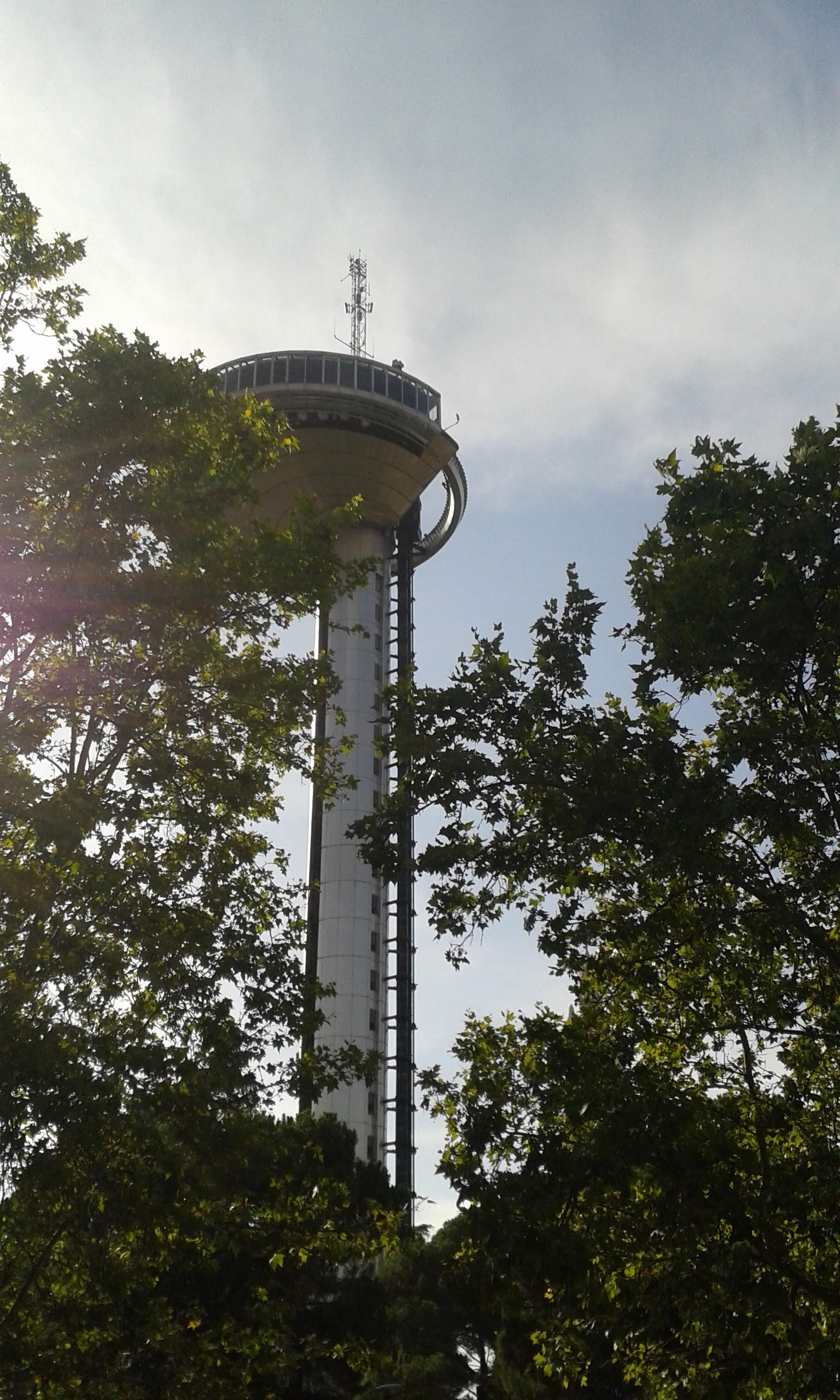
The single most recognisable landmark is the Faro de Moncloa, an observation tower built in the 1990s that offers views across the city from the plaza in front of the transport interchange. Nearby, on the edge of Parque del Oeste, stands the Templo de Debod, the Egyptian temple gifted to Spain and rebuilt on high ground overlooking the park and, on clear days, the Sierra de Guadarrama.
The district is also home to the Museo de América, a national museum dedicated to the archaeology and ethnography of the Americas, housed in a purpose-built 1940s building near the Faro de Moncloa. Argüelles, the barrio closest to the centre, connects directly to Plaza de España, which marks the practical boundary between this district and the Centro district proper.
None of these sites are grouped together for convenience; they reflect what was actually built here across different periods — royal hunting ground, university campus, Civil War front line, and postwar civic infrastructure — rather than a curated tourist route.
How does the transport hub at Moncloa work?
The Intercambiador de Moncloa, an underground bus station beneath Plaza de Moncloa, is one of Madrid’s principal transport interchanges. It connects Metro de Madrid lines with a large number of interurban bus routes serving the northwest of the region, including towns outside the city that are not reached by metro. For residents of the outer barrios — Aravaca, El Plantío, Valdemarín — this interchange, rather than any single metro line, is usually the practical link into the centre. Current routes and fares should always be confirmed on Metro de Madrid’s own site, since interurban bus networks change more often than the metro map itself.
How does Aravaca differ from the rest of the district?
Aravaca was an independent municipality until it was absorbed into Madrid in the 20th century, and it still functions more like a satellite town than an inner-city neighbourhood. Housing here is predominantly detached or semi-detached, streets are wider and quieter, and daily life depends more on cars and commuter rail than on the dense metro grid that serves the centre. It is a useful reminder that a single Madrid district can contain both a university campus a short walk from Gran Vía and a residential area that residents themselves would describe as suburban.
Who actually uses this district, and for what?
Moncloa-Aravaca serves three quite different populations at once: university students and staff concentrated around Ciudad Universitaria and Argüelles; families and joggers using Casa de Campo and Parque del Oeste; and long-term residents in the outer barrios who have little daily reason to cross into the centre at all. Visitors typically see only a narrow slice of this — the Faro de Moncloa, the Templo de Debod, perhaps the cable car — which is a fair sample of the district’s landmarks but not representative of how most of it actually operates day to day.
For a wider view of how Madrid’s districts compare to one another, the Neighbourhoods archive covers areas from the historic centre to the outer ring, and the Landmarks & Sights archive and Museums & Galleries archive cover the specific monuments and collections mentioned here in more depth.
Access Madrid is an independent guide written from published, checkable sources. We have not visited the places described here and we do not publish personal recommendations or invented ‘local favourites’ — where something is singled out as notable, we say who says so. Opening times, fares, closures and prices change at short notice, so treat everything here as a starting point and confirm with the museum, operator or venue directly before building a day around it. We give no advice on visas, insurance, health or safety; use your own government’s official guidance for those.
Featured image: Photo by Draceane, source, CC BY-SA 4.0
.jpg)
Related reading
Living in Madrid, Madrid, Practically.
Featured image: Photo by Carlos Delgado, source, CC BY-SA 3.0
